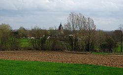
Galmaarden
Appearance
Galmaarden | |
|---|---|
 Vollezele | |
| Coordinates: 50°45′N 3°59′E / 50.75°N 03.99°E | |
| Country | |
| Community | Flemish Community |
| Region | Flemish Region |
| Province | Flemish Brabant |
| Arrondissement | Halle-Vilvoorde |
| Government | |
| • Mayor | Patrick Decat (CD&V) |
| • Governing party/ies | CD&V |
| Area | |
• Total | 35.29 km2 (13.63 sq mi) |
| Postal codes | 1570 |
| NIS code | 23023 |
| Area codes | 054 |
| Website | www.galmaarden.be |
Galmaarden (Dutch pronunciation: [ˈɣɑlmaːrdə(n)] ⓘ; French: Gammerages, French pronunciation: [ɡamʁaʒ]) is a small town in the municipality of Pajottegem in the Belgian province of Flemish Brabant. It is also situated in the Pajottenland.
References
[edit]External links
[edit] Media related to Galmaarden at Wikimedia Commons
- Official website - Only available in Dutch


